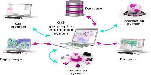
Geographic Information System (GIS): A geographic information system, or GIS, is a computerized data management system used to capture, store, manage, retrieve, analyze, and present all types of spatial or geographical data.
Support of GIS in decision making
Geographic or spatial information can assist in understanding the complex interrelationships of natural resources and human population as they relate to potential or known pollution sources. GIS assists in the preparation, analysis, display, and management of geographical data. It is a useful tool for analyzing data in policy making decision. This additional information is beneficial to us in accomplishing our mission of protecting human health and the environment. The EPA Mid-Atlantic Region has a GIS Team which provides the necessary spatial data to our Regional staff to assist in environmental decision-making. This involves:
- acquiring and maintaining accurate locational data of regulated facilities, pollutant sources and environmental resources,
- providing appropriate access to data,
- developing customized GIS maps, tools and applications, and
- providing technical assistance to support GIS needs.
GIS can also be thought of as a decision making an instrument to help strategy makers, planners, and researchers in taking proficient decisions related to problems requiring location-based analysis such as disaster management, city planning, e-governance, transportation etc.


