Satellite Crop Monitoring System for Efficient Farming
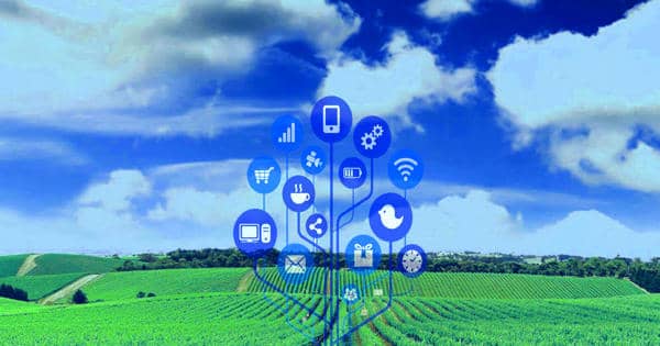
Satellite crop monitoring has resulted in many developments in the agricultural industry. The satellite crop monitoring system is a system that allows the farmer to perform real-time crop vegetation index monitoring by analyzing satellite images of different crops and fields so as to determine both the negative and positive development of the crops. Among many other uses, satellite monitoring is suitable for the precise weather forecasts on your farm location based on concrete field coordinates. By getting the different vegetation index of a firm over a period of time the farmer is able to determine whether there is an improvement in the farm or whether there is a deterioration in the farm. Along with other developments in remote sensing applications, data from satellite monitoring has become one of the critical sources of data in monitoring large-scale crop condition that is focusing on vegetation index analysis. From this analysis, the farmer is able to take any corrective measures that may be needed on the farm.
“Satellite monitoring is suitable for the precise weather forecasts on your farm location based on concrete field coordinates.”
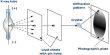
The satellite crop monitoring system allows a user to monitor crops that are in different fields, regions, and areas. In satellite-based remote sensing, Earth’s surface is illuminated by the Sunlight and a portion of the incident Sunlight is reflected or emitted by the surface. The satellite sensor receives the reflected or emitted sunlight coming from the surface after interaction with the surface features. After monitoring, the system performs an analysis of the different fields monitored and also an interpretation of the analyzed data for the various users. The key advantage of satellite imagery is that its data is at different spectral, spatial, and temporal resolutions for crop assessment, crop health, agriculture, crop change detection, irrigated landscape mapping, environmental analysis, yield determination, and soils analysis.
Remote Sensing – Satellite Crop Monitoring System
Consequences of global warming, climate change, sea-level rise phenomena have seriously affected the living world. Proper management and possible remedial approaches for mitigation largely dependent on the availability of reliable and timely information on major crops and is a crucial issue in addressing the problem. The development of remote sensing technology along with its repetitive and synoptic viewing capabilities has greatly improved our capability to monitor agricultural crops on a large scale on a repetitive basis. It is worth noting that these techniques employed depend highly on the type of remotely sensed data and the objectives of the end-user as well.
Categories of people who use the satellite crop monitoring system
- Agronomists and agricultural managers. The agronomists and the agricultural managers use the satellite crop monitoring system for management and optimization decisions of crops and resources used.
- Business owners. Business owners use this system to decide on reasonable capital investment for the business.
- State agencies. The state agencies use this system to make decisions on matters concerning food security and ecological problems.
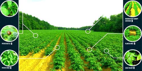
Apart from highlighting problematic areas, satellite images can assist in monitoring the effectiveness of applied preventive and any corrective actions that a farmer can choose to implement. To fully maximize the use of satellite images in monitoring farms, growers, farm managers, technicians, and crop consultants should first understand and have the ability to interpret the resultant image. Agriculture field monitoring for crop estimation and food security are relevant applications of satellite monitoring of crops as a type of agricultural technology.