Welsh mythology describes Cantre’r Gwaelod, a long-forgotten submerged kingdom that was supposedly discovered off the rugged beaches of Cardigan Bay in the Irish Sea. Although there hasn’t been much concrete proof of the existence of the “Welsh Atlantis,” a recent investigation of one of the oldest surviving maps of Britain raises the possibility that there is some truth to this well-liked tale.
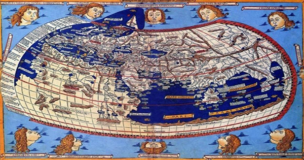
According to a paper in the journal Atlantic Geology, scholars from Swansea University and the University of Oxford recently examined the Gough Map, a well-known medieval map of Britain, and found that it appears to show two enigmatic islands off the west coast of Wales.
The Gough Map is accessible at this site.
Although the majority of current estimates place its creation in the 13th or 14th centuries CE, no one is certain who developed the map, how it was built, or even when it was published. The Gough Map is one of the oldest maps to depict Britain in a geographically recognizable form, despite its (to put it mildly) sparse detail.
According to Simon Haslett, study author and honorary professor of physical geography at Swansea University, “The Gough Map is extremely accurate considering the surveying equipment they would have had at their disposal at that time.”
The two islands are clearly identified, which could support reports from the time that a lost land was referenced in the Black Book of Carmarthen.
The Welsh coastline may have been 13 kilometers (8 miles) farther west than it is today, according to coordinates noted by the Roman cartographer Ptolemy, which the researchers also examined in addition to the map.
The pair thinks they have uncovered the elusive origins of the Cantre’r Gwaelod legend using these two lines of evidence.
It can be difficult to distinguish between fact and fiction, however it is conceivable to assert that two drowned islands that are now exaggerated in local tradition originally sat in Cardigan Bay.
These two islands may have been created from silt and clay that were left over following the end of the last ice age some 10,000 years ago, according to the experts. These malleable glacial deposits were finally swept away by water erosion, storms, etc.
Numerous poetry, songs, and stories have been influenced by Cantre’r Gwaelod over the years. The kingdom, according to tradition, consisted of as many as sixteen cities and was headed by a fictitious monarch called Gwyddno Garanhir.
According to legend, Seithennyn, a friend of the monarch, was given the responsibility of locking the sea gates each night. However, one stormy night at the king’s palace, Seithennyn drank a few too many drinks and neglected to finish his duties, which led to the islands flooding.
Given the paucity of trustworthy physical evidence, it appears incredibly implausible that these two islands were actually the residence of a vast old monarchy.
However, a legendary tale featuring the concepts of a great flood and a long-lost sea civilisation can be found in various human societies from all over the planet. These tales, it has been believed, reflect the collective memory of the enormous floods that occurred after the end of the last ice age, when enormous ice-dammed lakes in Eurasia and North America gave way and flooded the region with waves.
Perhaps the mythology of Cantre’r Gwaelod is really another imagined sea flood, similar to China’s Gun-Yu flood myth and the Genesis account of Noah’s arc.