Pressure and Winds of the Hot Weather Season in Indian Subcontinent
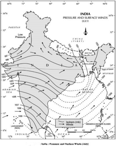
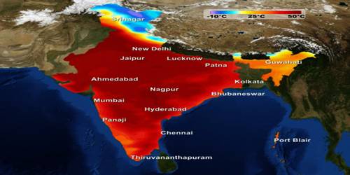
The months of March, April and May are the summer months in India. The summer months are a period of excessive heat and falling air pressure in the northern half of the country. Because of the heating of the subcontinent, the ITCZ moves northwards occupying a position centered at 25°N in July. Roughly, this elongated low-pressure monsoon trough extends over the Thar Desert in the north-west to Patna and Chotanagpur plateau in the east-southeast (Figure). The location of the ITCZ attracts a surface circulation of the winds which are southwesterly on the west coast as well as along the coast of West Bengal and Bangladesh. They are easterly or south-easterly over north Bengal and Bihar. It has been discussed earlier that these currents of southwesterly monsoon are in reality ‘displaced’ equatorial westerlies. The influx of these winds by mid-June brings about a change in the weather towards the rainy season.

In the heart of the ITCZ in the northwest, the dry and hot winds are known as ‘Loo’, blow in the afternoon, and very often, they continue to well into midnight. Dust storms in the evening are very common during May in Punjab, Haryana, Eastern Rajasthan, and Uttar Pradesh. These temporary storms bring a welcome respite from the oppressing heat since they bring with them light rains and a pleasant cool breeze. Occasionally, the moisture-laden winds are attracted towards the periphery of the trough. A sudden contact between dry and moist air masses gives rise to local storms of great intensity. These local storms are associated with violent winds, torrential rains, and even hailstorms.


