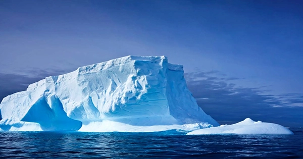
A Cornell research team and international collaborators report first-of-their-kind observations beneath the floating shelf of a vulnerable Antarctic glacier to reveal widespread cracks and crevasses where melting occurs more quickly, contributing to the Florida-sized glacier’s retreat and possibly to sea-level rise.
The team obtained the first up-close views of the critical area near the grounding line where Thwaites Glacier in western Antarctica, one of the continent’s fastest-changing and most unstable glaciers, meets the Amundsen Sea by deploying the remotely controlled Icefin underwater robot through a nearly 2,000-foot-deep borehole drilled in the ice.
The researchers deduced that Thwaites has been retreating up the ocean floor from that region since at least 2011. They discovered that the flat areas that covered a large portion of the base of the ice shelf were thinned, though not as quickly as computer simulations had predicted. At the same time, the walls of the stair-like formations and sharply sloping crevasses were melting outward at much faster rates.

The research, which was published on February 15 in the journal Nature, offers fresh information on how glaciers that are exposed to very warm ocean water melt, and it has the potential to enhance models that predict Thwaites’ potentially major contribution to sea level rise.
According to Britney Schmidt, associate professor of astronomy and earth and atmospheric sciences in the College of Arts and Sciences (A&S) and Cornell Engineering, “these new methods of observing the glacier allow us to understand that it’s not just how much melting is happening, but how and where it is happening that matters in these very warm parts of Antarctica.” “Across warming glaciers like Thwaites, we see crevasses and perhaps terraces. Warm water is seeping through the fissures and weakening the glacier where it is most vulnerable.
Heterogeneous Melting Near the Thwaites Glacier Grounding Line and Suppressed Basal Melting in the Eastern Thwaites Glacier Grounding Zone are both co-authored by Schmidt, whose team developed Icefin, with oceanographer Peter Davis of the British Antarctic Survey as the first author (BAS).
The National Science Foundation and the Natural Environment Research Council of the United Kingdom funded the International Thwaites Glacier Collaboration (ITGC), the largest international field campaign ever conducted in Antarctica, which included the collection of the robotic under-ice observations in early 2020. Partners on the ITGC’s MELT project also gathered data using radar, ocean moorings, and other sensors at various sites to supplement Icefin’s observations.
According to ITGC, the Thwaites grounding line has moved back nearly 9 miles since the 1990s, and the amount of ice streaming out of the 75-mile-wide area has almost doubled. The glacier is thought to be vulnerable to rapid ice loss that might cause sea levels to rise by more than 1.5 feet because a large portion of it is below sea level. According to BAS, the ice sheet behind Thwaites might collapse and contribute significantly more, “with serious ramifications for humanity.”
The BAS team observed that during a nine-month period, the seawater in that area became warmer and saltier. They utilized hot water to drill the borehole Icefin accessed about one mile from the Thwaites grounding line. Interestingly, the vertical melt rate across most of the ice ranged from 6 to 18 feet per year, which was less than originally predicted.
Even if Davis’ findings were surprising, the glacier was still in peril. The amount of ice leaving the continent will equal the amount of ice being lost by melting and iceberg calving if an ice shelf and a glacier are in equilibrium. It appears that it doesn’t take much to drive the glacier out of balance given that there is still fast glacial retreat despite even minor levels of melting.
The stratification and mixing of the water was what the researchers blamed for the variable melt rates in the various topographies. A thin freshwater layer that has melted acts as a barrier to the warmer ocean currents along flat areas of ice, preventing upward melting. In contrast, water flowing through sloped crevasses and scalloped terraces transfers heat at estimated rates of up to 140 feet per year, promoting faster sideways melting.
In order to explore previously unexplored terrain, such as grounding lines, Schmidt and her team of students and professionals, including Meister, Dichek, and Lawrence, started creating Icefin about ten years ago when they were still at the Georgia University of Technology. The pencil-shaped vehicle, which is less than 10 inches in diameter and more than 12 feet long and is equipped with thrusters, cameras, mapping tools, and sensors for measuring ocean current speeds, temperature, salinity, and oxygen levels—information needed to calculate melt rates—is designed to descend through narrow boreholes.
NASA has aided in the ongoing development of Icefin, a fourth-generation vehicle for which construction is now underway. The space agency thinks that learnings from the Antarctic could help future missions looking for life on the ice moons Europa and Enceladus in addition to strengthening climate models.
Additionally, co-authors from New York University, New York University Abu Dhabi, Georgia Institute of Technology, Oregon State University, University of Portland, Lewis & Clark College, Pennsylvania State University, University of Kansas, University of California, Irvine, California Institute of Technology, University of Gothenburg in Sweden, as well as the Universities of St. Andrews and East Anglia in the United Kingdom, are included in the recently published research.