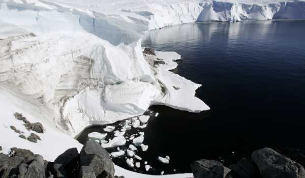
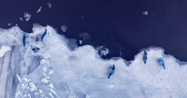
Over millions of years, the Antarctic Ice Sheet, Earth’s southern polar ice sheet, has grown, receded, and grown again. This shifting mass has an impact on the planet’s climate and sea levels, with historical data stored in sediment, meltwater, and surrounding oceans. However, due to the sheet’s remote and difficult location, researchers have limited access to collect samples and data that may reveal missing pieces in the ebb and flow of historic climate changes. The findings were published in the journal Geology.
“An accurate reconstruction of Antarctic Ice Sheet changes is required to develop a deeper understanding of ice-sheet response to climate change,” said Takeshige Ishiwa, a postdoctoral researcher at the National Institute of Polar Research’s Research Organization of Information and Systems.
Ice cores contribute to our understanding of past climate in a unique way because the bubbles within the ice capture the gas concentration of our well-mixed atmosphere while the ice itself records other properties. Ice is typically the only environmental data available for scientists to reconstruct the climate hundreds to thousands of years ago at the Earth’s highest latitudes and altitudes.
The Antarctic Ice Sheet, Earth’s southern polar ice sheet, has grown and receded and grown again over millions of years. This changing mass influences the planet’s climate and sea levels, with historic data recorded in sediment, meltwater and surrounding oceans
Scientists obtain this information by traveling to ice sheets such as Antarctica or Greenland and using a special drill to bore into the ice and extract a cylindrical tube known as an ice core. Drilling thousands of meters into ice is a feat of technology, endurance, and persistence in extreme environments, as demonstrated by the joint Russian, American, and French team that worked together in 1987 to recover the iconic record of atmospheric CO2 from the ice at the Russian Vostok Station in Antarctica. Russian scientists extended the ice core to 3,768 meters in 2012, reaching Lake Vostok beneath the East Antarctic Ice Sheet.
According to Ishiwa, ice sheet changes prior to the Last Glacial Maximum, approximately 20,000 years ago, when the world’s ice sheets were at their most extensive, have not been well documented. There are inconsistencies in modeled data and geological observations due to the scarcity of records. For example, despite a global sea level drop of more than 40 meters prior to the Last Glacial Maximum, sedimentary samples from two East Antarctic bays show that sea levels did not differ significantly from modern measurements.

To better understand this inconsistency, the researchers created a model of how land moves beneath the ice sheet, a process known as glacial isostatic adjustment. Even when the ice melts, the land is altered and moves differently as a result. The researchers ran various scenarios and discovered that only one seemed to explain the sea level difference.
“Our glacial isostatic adjustment modeling results show that the Indian Ocean sector of the Antarctic Ice Sheet would have needed to experience excess ice loads prior to the Last Glacial Maximum to explain limited geological data,” Ishiwa said. “We propose that the Antarctic Ice Sheet reached a portion of its maximum thickness prior to the Last Glacier Maximum.”
The thicker ice appears to have depressed the continent, changing the gravitational field of the land and sea, resulting in the high sea levels, according to Ishiwa. Scientists can learn about temperature, precipitation, atmospheric composition, volcanic activity, and even wind patterns from ice cores.
Scientists can determine how much snow fell in the area during a given year by measuring the thickness of each layer. Scientists can also determine wind patterns based on where the snow drifted, which can be interpolated from the thickness of the layers in the cores when several cores are taken from nearby locations. Furthermore, the chemical composition of the snow itself can tell scientists about the local temperatures because colder temperatures result in a higher concentration of a specific oxygen isotope in the snow.
Dust from nearby locations can also accumulate in the layers of the ice cores, depending on atmospheric conditions. Aside from seasonal dust, massive volcanic eruptions anywhere on the planet can spew massive amounts of dust into the atmosphere, which can accumulate in the ice. All of the dust layers, together with the chemical composition of the ice and a flow model that evaluates how the ice accumulates over time, allow scientists to date the ice cores.
“Geological evidence supports our glacial isostatic adjustment-based Antarctic Ice Sheet reconstruction before the Last Glacial Maximum,” Ishiwa said, noting that sediment and meltwater data show that the ice sheet had partially decayed before the LGM. To better understand changes in the Antarctic Ice Sheet, the researchers intend to conduct another field survey and collect additional geological data.


