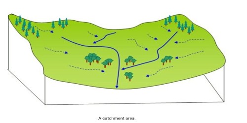
Catchment Area: The area drained by a major river and its tributaries. It is the area from which rainfall flows into a river, lake, or reservoir.
The catchment area is generally connected with Rivers in Hydrology, as this region states the area from a river typically gets its water or decant out, that can differ from rivers to lakes be in meters or in km. The amount of water reaching the river, basin, or lake from its catchment area depends on the size of the region the amount of rainfall, and the loss through desertion and through amalgamation by the soil or by vegetation; amalgamation is bigger when the soil or rock is permeable than when it is resistant.
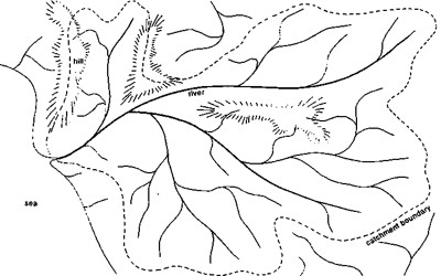
Fig: Catchment Area of a river
Therefore, a catchment area is a region of land, where the surface water from precipitation, snowmelt, or ice flow into a lower altitude to form a single body of water, that may be a lake or a river. It is perception under Watershed Analysis (in which the catchment area is being analyzed with reference to its flow and to understand the relevance of it with Land + Slope + Aspect and Direction also).