Cirrocumulus Clouds: Patchy white high altitude cloud composed of ice crystals. Found in an altitude range from 5.000 – 18.000 m. This happens because of the unbalanced air in the cloud stage giving the cloud its cumuliform look. In addition, cirrocumulus clouds also grow when cirrostratus or cirrus clouds are warmed, causing the air to increase and sink into the cloud.
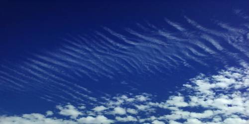
Cirrocumuli are high-level clouds appearing as a shape of little masses of white or pale blue, fleecy clouds in a globular, wavelike, rippled pattern, typically infrequently arranged groupings.
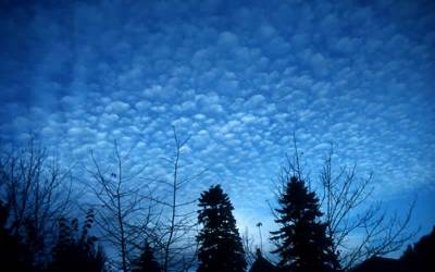
Cirrocumulus are composed of greatly supercooled water droplets (which tend to be converted into ice crystals very fast), ice crystals, or a combination of both. The even-sized cloud particles may create coronae and iridescence around the Sun or Moon.
Cirrocumulus clouds are clouds that have little white feathers forming stunning patterns spreading out hundreds of miles all over the sky. These clouds sometimes come into view in greyish color that resembles fish scales earning the name “mackerel skies”. Cirrocumulus clouds do not come into view with other types of clouds to create better cloud structures. Furthermore, they do not produce precipitation even though they denote cold climate.